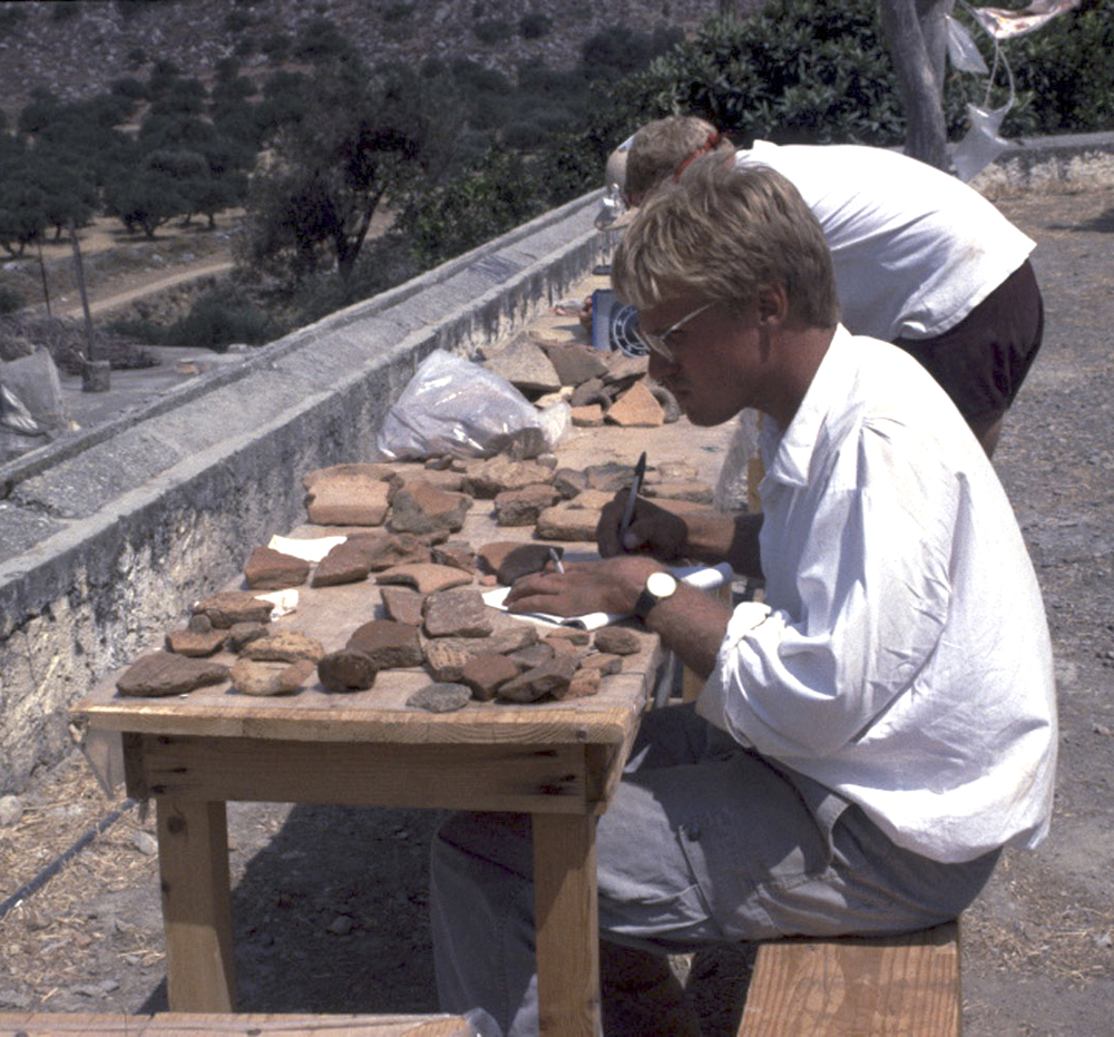
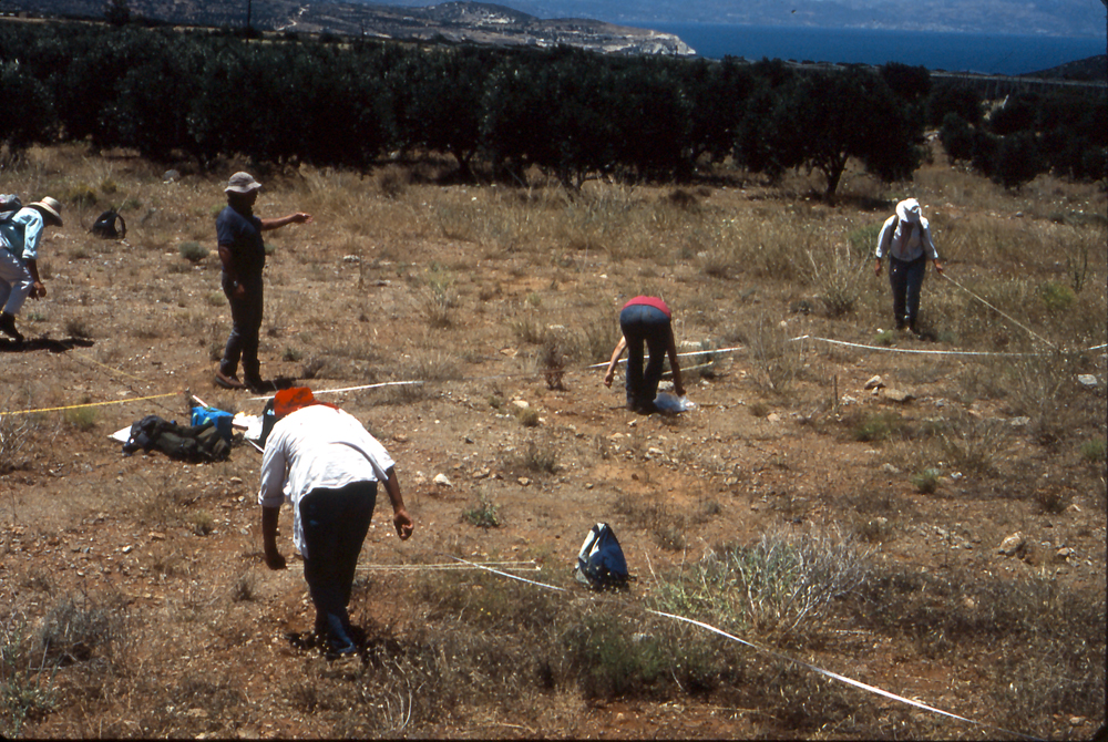
The Mirabello region has been the focus of extensive archaeological research since 1900, especially in the wider vicinity of the INSTAP Study Center for East Crete. In addition to several excavations (e.g., Mochlos, Azoria, Vronda, Kastro, Chrysokamino, Pseira, Chalasmenos, Katalimata, Vasiliki Kephala, Vasiliki, Gournia, Priniatikos Pyrgos, Vrokastro), four intensive surveys (Gournia, Kavousi-Thriphti, Pseira, and Vrokastro) have explored the broader landscape. The combined results offer one of the most detailed settlement histories for any region in the Aegean, and it is noteworthy that all four surveys have been fully published.
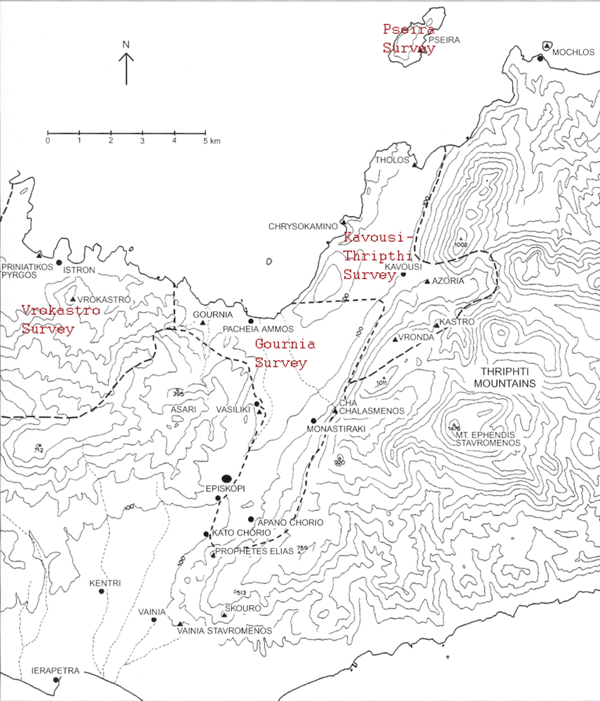
The Kavousi-Thriphti Survey was conducted by Donald Haggis from 1988 to 1990, in conjunction with the Kavousi Project’s excavations at Vronda and Kastro, as part of his doctoral dissertation. This survey investigated the area of the district of Kavousi on the eastern edge of the Mirabello region, and it identified 101 sites of varying types, spanning the Final Neolithic (FN) to the Late Roman (LR) period. The area surrounding the Chrysokamino habitation site and metallurgy workshop, which was included in Haggis’ survey, was further investigated (preliminary mapping and geological survey) in 1995 as part of the Chrysokamino Project.
The Gournia Survey was conducted in 1992–1994 under the direction of L. Vance Watrous. This project investigated the area around the site of Gournia and the northern Isthmus of Ierapetra (to the southwest of the Kavousi-Thriphti Survey). A total of 144 sites were identified, spanning Final Neolithic to Late Roman.
The Pseira Project, under the direction of Costis Davaras and Philip Betancourt, included an intensive survey (supervised by Richard Hope Simpson), which investigated all of the 1.75 km² of the island. The survey (1985–1989) recorded 315 specific locations with architecture, pottery, or other human remains, and it covered the Final Neolithic to Byzantine periods.
The Vrokastro Archaeological Survey Project (1986–1989), directed by Barbara Hayden and Jennifer Moody, investigated the south-central part of the Mirabello region, to the west of the Gournia survey area. It recorded a minimum of 125 sites, ranging from the Final Neolithic to the Ottoman period.
This unprecedented level of research allows for the reconstruction of a detailed, diachronic settlement history for the region. The earliest recorded settlement in the Mirabello region dates to the Final Neolithic period. Few sites have been recorded from this period, and they typically represent small, scattered hamlets, farms, and field houses or camps located inland on low slopes, though there are also a few larger settlements, such as Katalimata, Vasiliki Kephala, and Azoria, which are located on high defensible hilltops. These sites appear to represent small independent communities for which some burials have been identified.
The Early Prepalatial period (Early Minoan [EM] I–II) shows a significant increase in the number of sites (including settlements, burials, and special-function sites such as for knapping or ore smelting). The EM I sites are often found in high defensible locations, while settlement expands into coastal and inland valley areas in EM II. There is also evidence for population growth, and some settlements grow considerably larger in size (e.g., Pseira, Mochlos, Priniatikos Pyrgos, Gournia, Vasiliki), indicating the emergence of settlement hierarchy.
In the Late Prepalatial period (EM III–Middle Minoan [MM] IA) many sites were abandoned, reduced in size, or destroyed, especially small coastal ones. However, there is evidence for nucleation or growth at other sites, such as Priniatikos Pyrgos and Gournia, and some new sites were founded in defensible locations. The settlement pattern in this period consisted of a series of site clusters, as opposed to the evenly dispersed pattern visible in the previous period.
The Protopalatial (MM IB–II) period is characterized by a significant increase in the number of sites, especially small ones, such as farmhouses, and presumably population as well. More diverse environments were also settled and exploited, especially high up in the hills. Most sites continued from the previous period, and the largest sites grew even bigger. The sites were concentrated in dispersed clusters, in a few cases around a single large settlement, such as Gournia.
There is an overall reduction in the number and size of settlements in the Neopalatial (MM III–Late Minoan [LM] I) period; in fact, some sites were destroyed at the end of MM II. In particular, many small sites were abandoned in favor of large nucleated settlements, which reach their maximum size in this period (e.g., Gournia, Priniatikos Pyrgos). However, numerous new small sites, especially farms or field houses, as well as a few “megalithic farmsteads or country houses” on hilltops, were also founded.
In LM IIIA–IIIB there is a large reduction in the number and size of sites, interpreted as reflecting significant depopulation of the area; in fact, some sites, such as Gournia, Mochlos, and Pseira had been destroyed at the end of LM IB. Most sites were also located inland, away from the coast. Very few new sites were founded in this period, and habitation commonly consisted of the reoccupation of Neopalatial houses.
At the beginning of LM IIIC the previous sites on the plain and by the coast were abandoned, and new settlements were founded in defensible mountain locations. Over the course of the period, there was an overall increase in the number of sites, and some settlements grew in size. In Protogeometric–Geometric many sites were abandoned in favor of fewer sites, which became regional centers. Sites were often still organized in clusters; for example, at Vrokastro, smaller settlements were located around primary, nucleated centers.
Additional sites were abandoned in the Orientalizing and Archaic periods, and the pattern of nucleation continued, moving toward the development of the polis by the Archaic period; in that period, three major sites (Prophetes Elias, Azoria, and Istron) dominated the survey area. Less is known about the Classical period, though there appears to have been little change in settlement patterns, and further nucleation occurred; a few new sites were founded on the coast, especially in the Vrokastro survey area, while Prophetes Elias and Istron grew in size and comprised the primary settlements in their respective survey zones (Azoria was destroyed at the beginning of the 5th c. B.C.; Oleros also grew in size).
Most of the larger Classical sites continued into the Hellenistic period. Although there is limited evidence for settlements in the Kavousi and Gournia regions before the 2nd century B.C., numerous sites of this date existed in the Vrokastro area. The Early and Late Roman periods show the presence of a large number of new rural sites in the isthmus and Kavousi regions (hamlets, farmsteads, and villages), while the Vrokastro area shows continuity or even a slight contraction of size. In the Kavousi area for example, the LR pattern of ruralization is manifested as a series of regularly spaced, nucleated villages or large hamlets of similar size, population, and area of agricultural land.
Selected References
Betancourt, P.P. 2006. The Chrysokamino Metallurgy Workshop and Its Territory (Hesperia Suppl. 36), Princeton.
Betancourt, P.P., and C. Davaras, eds. 2002. Pseira VI: The Pseira Cemetery 1. The Surface Survey (Prehistory Monographs 5), Philadelphia.
Betancourt, P.P., C. Davaras, and R. Hope Simpson, eds. 2004. Pseira VIII: The Archaeological Survey of Pseira Island. Part 1 (Prehistory Monographs 11), Philadelphia.
———. 2005. Pseira IX: The Archaeological Survey of Pseira Island. Part 2: The Intensive Surface Survey (Prehistory Monographs 12), Philadelphia.
Haggis, D.C. 2005. Kavousi I: The Archaeological Survey of the Kavousi Region (Prehistory Monographs 16), Philadelphia.
Hayden, B.J. 2004. Reports on the Vrokastro Area, Eastern Crete 2: The Settlement History of the Vrokastro Area and Related Studies (University Museum Monograph 119), Philadelphia.
Hayden, B.J. 2005. Reports on the Vrokastro Area, Eastern Crete 3: The Vrokastro Regional Survey Project: Sites and Pottery (University Museum Monograph 123), Philadelphia.
Watrous, L.V., D. Haggis, K. Nowicki, N. Vogeikoff-Brogan, and M. Schultz. 2012. An Archaeological Survey of the Gournia Landscape. A Regional History of the Mirabello Bay, Crete, in Antiquity (Prehistory Monographs 37), Philadelphia.