We collect and interpret subsurface data from archaeological sites with a ground penetrating radar (GPR) system from Geophysical Survey Systems, Inc. This technology is ideal for archaeological applications because it is a nonintrusive, and therefore nondestructive, method of survey enabling the archaeologist to see what is below the surface before any trenches are excavated. By detecting the location of features within a grid, the archaeologist can identify promising features underground and can excavate that particular area.
The Geophysics Lab has assisted many archaeological projects in recent years including Apesokari, Mycenae, Papadiokampos, Pylos, and Thisve among several others.
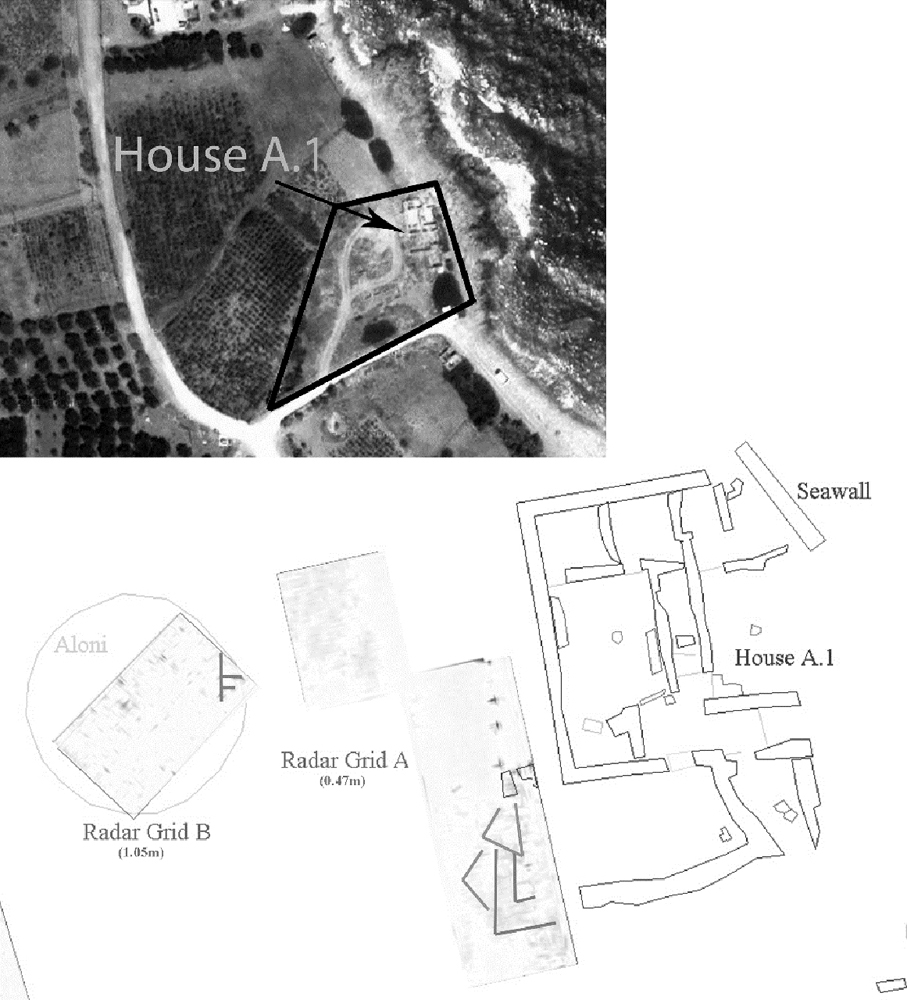
The GPS system is operated by a trained member of the INSTAP Publication Team primarily during summer months. Data is collected in individual transects, or profiles, along an x-y axis, and depth is recorded in time (nS), which can be converted to meters. After data collection, the files are transferred to a computer and processed.
The equipment consists of an SIR-2000 (Subsurface Interface Radar) 400MHz antenna, an attachable survey wheel, two connector cables (1.83 m and 30 m), a transfer cable, two 12V batteries with a charger, battery and car-lighter power adapters, an instructional video, and RADAN processing software with its security key on a laptop. Because the radar signal does not show exactly what an underground feature looks like, processing is necessary to clean the scans of any extra “noise” and false points. Once the profiles are processed, RADAN then connects each individual profile and creates a three-dimensional model of the survey grid. Elevation from an electronic distance measuring device (EDM) can also be added during processing to adjust the scans according to the topography in order to give more accurate depth measurements.
Equipment
The following measurement systems and illustration tools are utilized by the Geophysics Laboratory: SIR-2000 (Subsurface Interface Radar) 400 MHz antenna, laptop computer with RADAN software, Topcon Hiper V and Hiper Pro Differential GPS, Topcon GTS-105N and GTS-303D electric total stations, and Wacom Cintiq 22HD and 24HD pen display screens.
Staff
Antonia Stamos received her Ph.D. in Art History from Temple University in Philadelphia in 2006. Her dissertation, “Through the Looking Glass: Applications of Ground Penetrating Radar in Archaeology“, explores the use of GPR for subsurface prospection at several sites in Greece. She joined the INSTAP Publication Team in 2001, and since 2002 she has supervised the work of the Geophysical Lab at sites in Greece. She has been a member of the Dickinson Excavation Project and Archaeological Survey (DEPAS) Team at Mycenae since 2003 and the Papadiokampos Project since 2006. At both sites, she initiated the remote sensing work with GPR prior to excavation. When not working on projects in Greece, Antonia is an assistant professor of Art History at the American University of Kuwait.
Recent Publications
Maggidis, Ch. 2014. “Rediscovering a Giant,” Popular Archaeology 16.
Maggidis, Ch., and A. Stamos. 2006. “Detecting Mycenae: Systematic Remote Sensing Survey in the ‘Lower City’– Towards the Discovery of the Mycenaean Settlement Outside the Citadel,” in From Space to Place: 2nd International Conference on Remote Sensing in Archaeology. Proceedings of the 2nd International Workshop, CNR, Rome, Italy, December 4–7, 2006 (BAR-IS 1568), S. Campana and M. Forte, eds., Oxford, pp. 157–166.
Stamos, A., Ch. Sofianou, and T. Brogan. 2015. “Making the Invisible Visible. Ground Penetrating Radar at Papadiokampos, Crete,” in Minoan Archaeology. Perspectives for the 21st Century. Proceedings of the International PhD and Post-Doc Conference at Heidelberg, 23-27 March 2011, S. Cappel, U. Günkel-Maschek, and D. Panagiotopoulos, eds., Louvain, pp. 53–60.
Tyree, L., D. Sphakianakis, A. Stamos, J. Frey, M. Belidis, and S. Kamnakis. 2011. “Speleography of Skoteino: Natural Relief Formations of the Cave’s Interior, with Special Reference to Late Bronze Age Ritual Activity,” in Πεπραγμένα του Ι΄ Διεθνούς Κρητολογικού Συνεδρίου A’(3), Chania, pp. 717–732.
Tyree, L., F. McCoy, J. Frey, and A. Stamos. 2014. “3D Imaging of Skoteino Cave, Crete, Greece: Successes and Difficulties,” JFA 39, pp. 180–192.