The goal of the lab is to illustrate various types of archaeological work for publication, including drawing small finds and pottery and drawing and mapping architectural remains. The lab cooperates with several excavations and individual archaeologists working on material at the Study Center. In recent years, for example, many archaeological projects benefited from the work of the Drafting Lab: Azoria, Gournia, Limantepe, Mesorachi, Mochlos, Petras, Juktas Peak Sanctuary, Zakros Palace, and Inatos Cave among several others.
Illustration of Artifacts
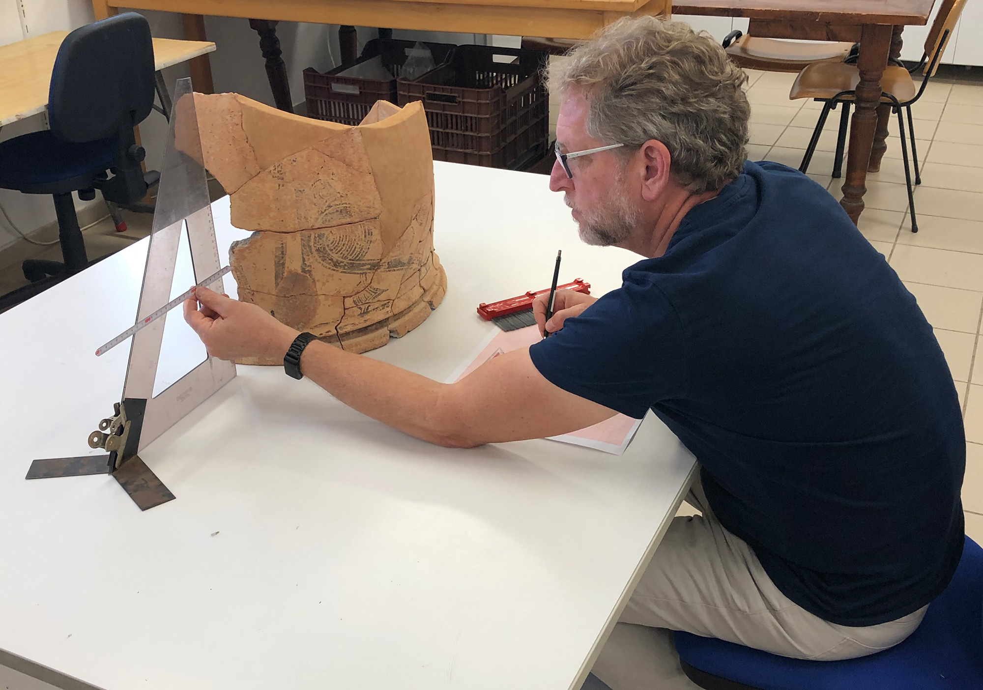
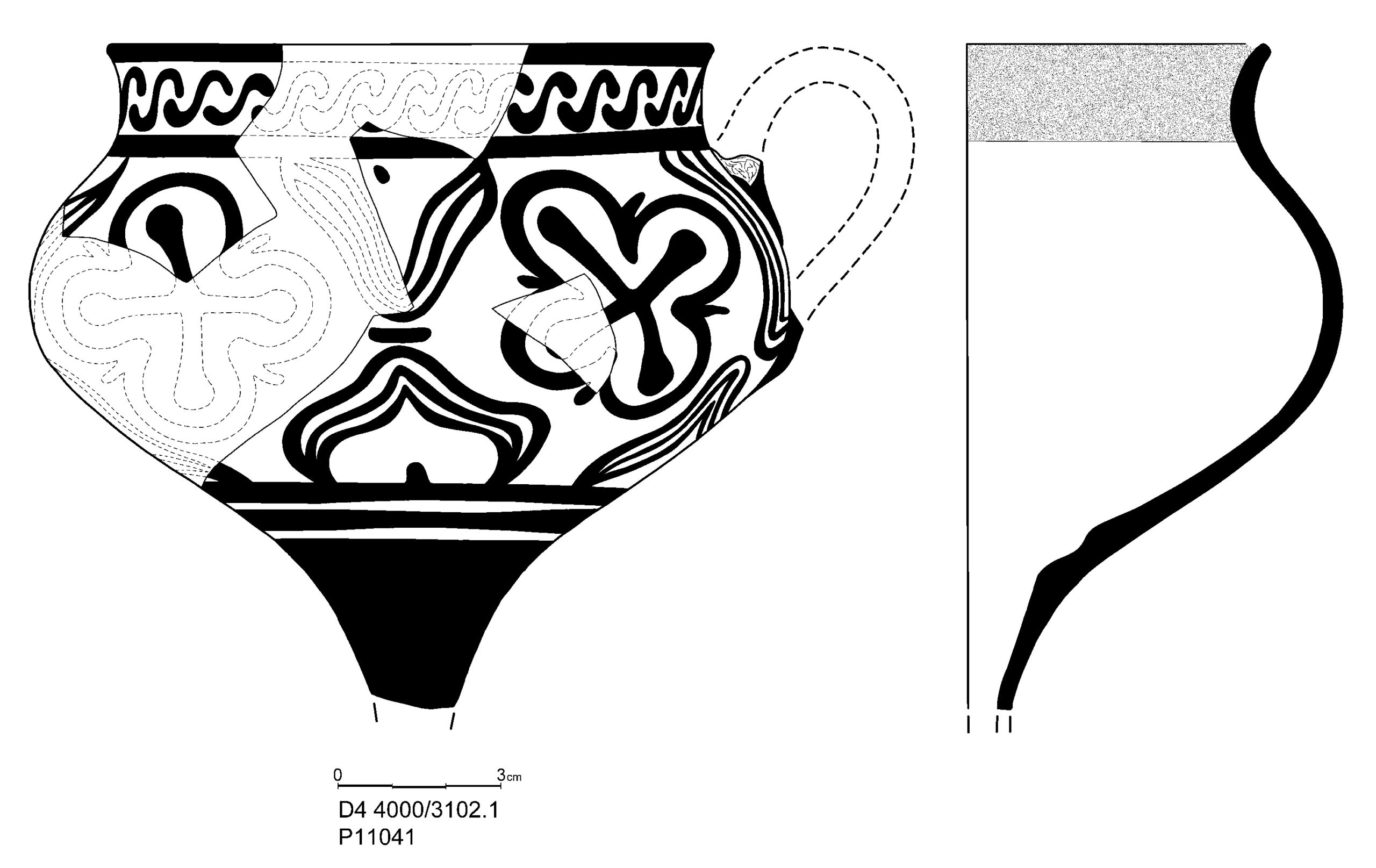
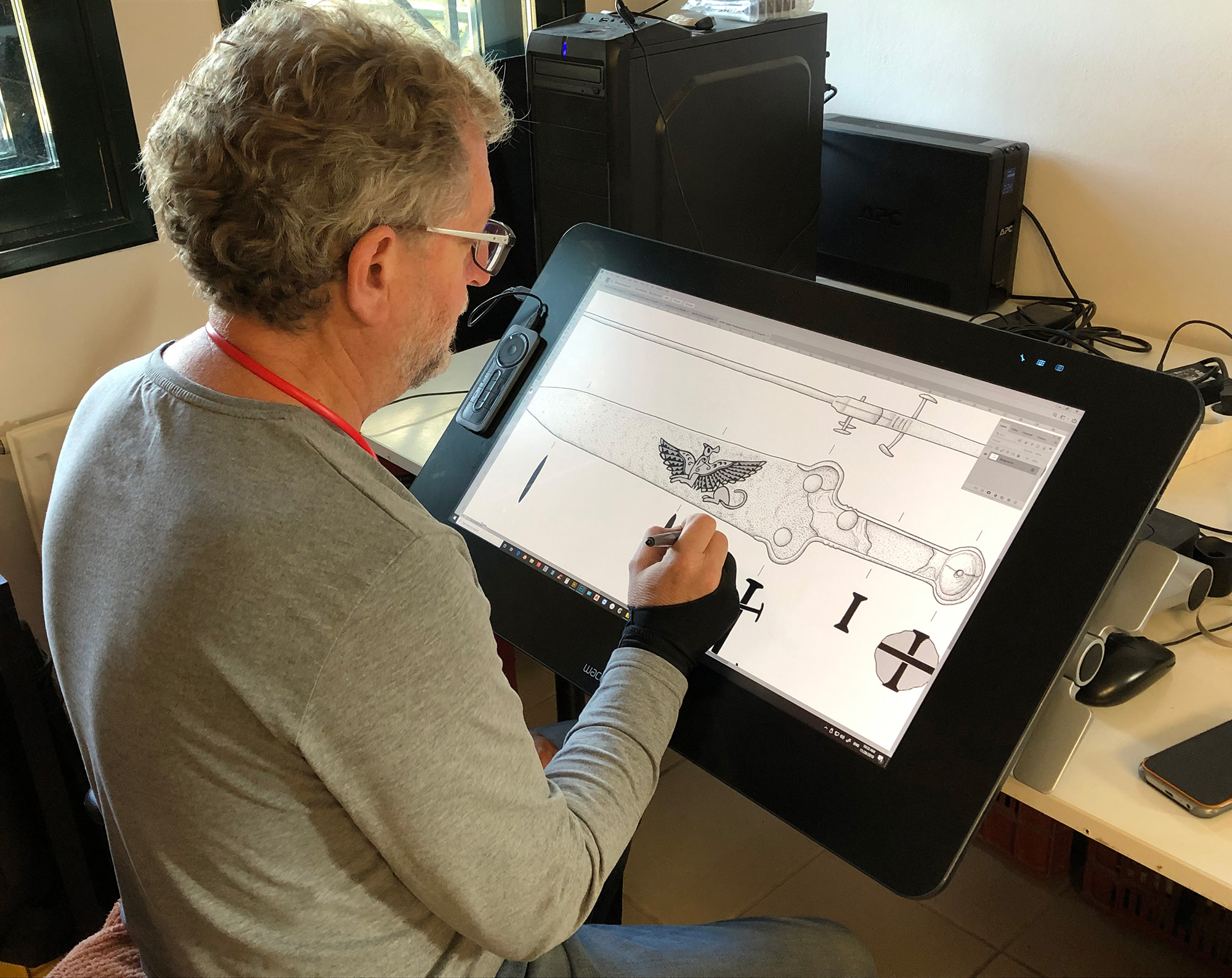
The lab is equipped to illustrate any type of artifact, including but not limited to, ceramics, stone, metal, and organic material. Since the opening of the Study Center in 1997 the methods for creating these illustrations have changed drastically. Although pencil drawings are still done using the same observation and measuring techniques as in the past, the development of digital technology since 2007 has greatly changed the way the drawings are finished and published. In the past, drawings were finalized using Rapid-o-Graph ink pens on frosted Mylar film. Today the final inking is done using computers and programs such as Adobe Photoshop and Illustrator. Also, touch screens have made it possible to digitize these drawings using digital pens that allow the artist to draw directly onto the screen. This technique has made it much easier and faster to create quality inked drawings that are already in digital format and therefore ready for publication.
Architectural Plans, Site Maps, and 3D Images
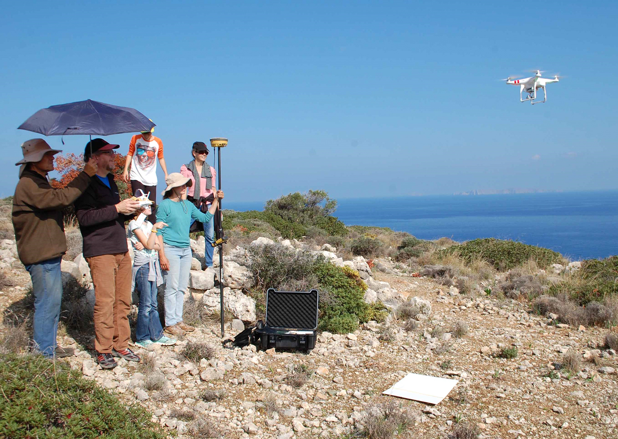
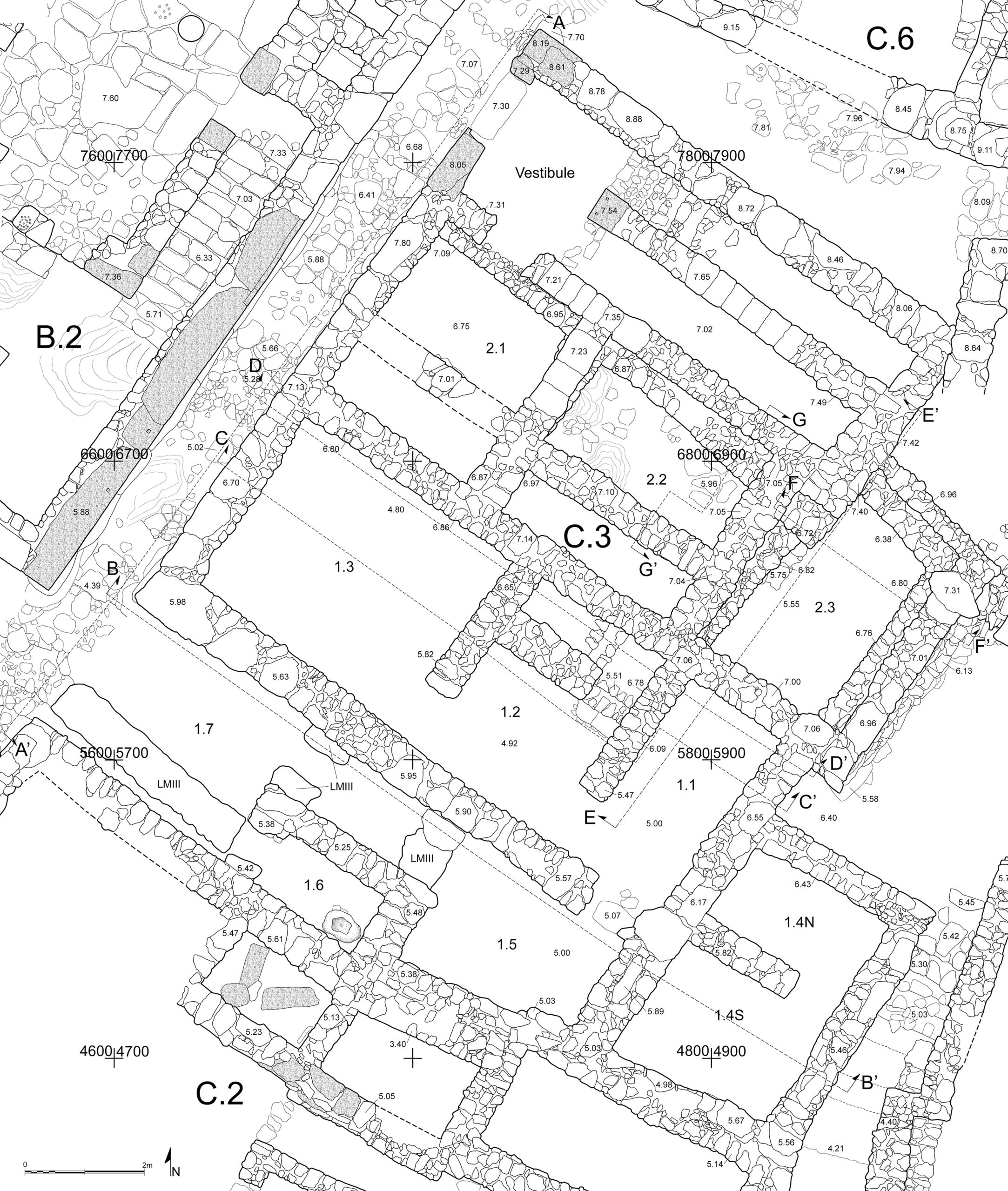
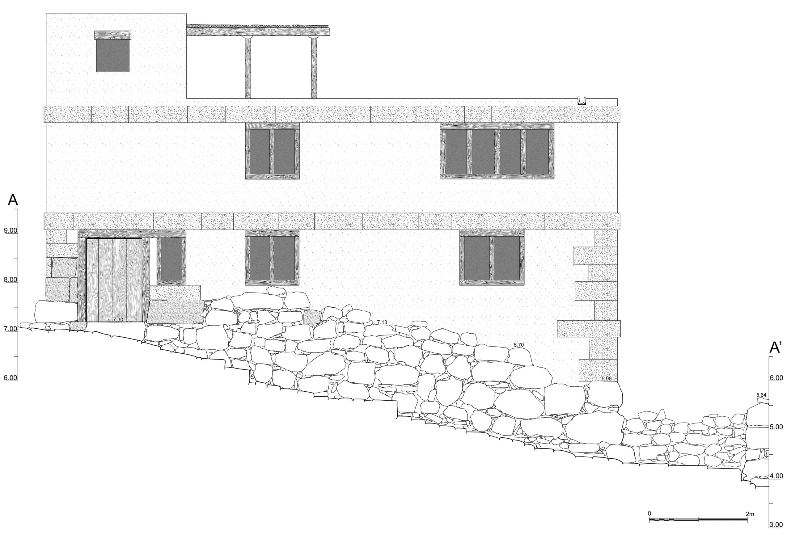
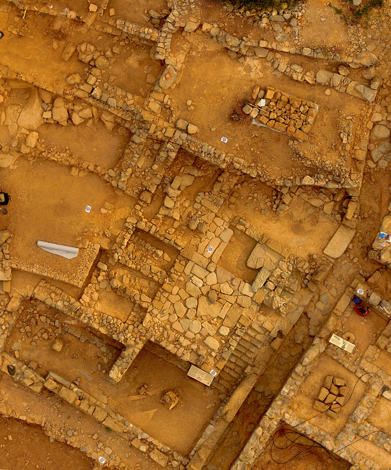
The lab also creates architectural plans and maps. The initial drawing is done on site, and it is finished back in the lab. Once again, things have changed drastically in this area of illustration since the advent of digital technology, perhaps even more so than the illustration of finds. Not only are the drawings finished on the computer, but they are increasingly done using the latest digital tools, including a differential global positioning system (DGPS), three dimensional (3D) photogrammetry, and drone aircraft.
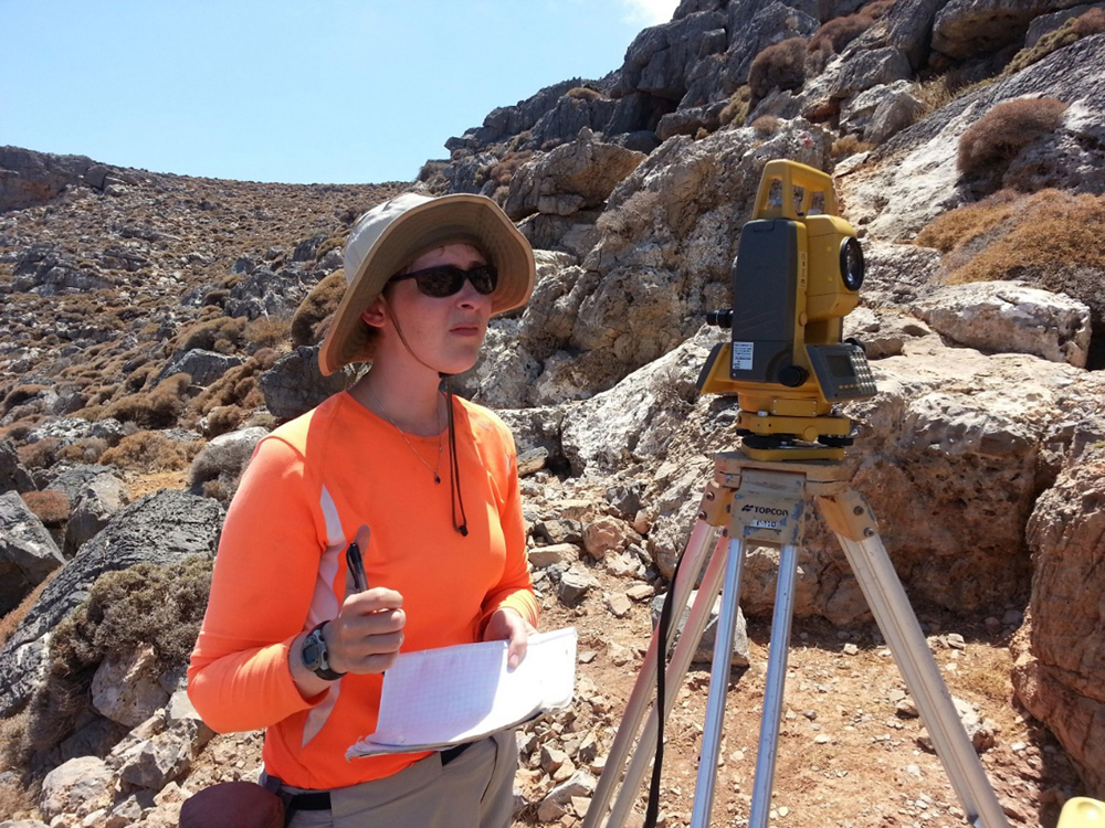
The DGPS works the same as any handheld device, such as cell phones or car navigation systems, using satellites to triangulate and determine its position, with the difference being that it also utilizes a base station and a pre-existing coordinate to make measurements with a high degree of accuracy, usually within 1 cm. This enables the person mapping the site to record architecture and other geographical features more quickly and easily than the previous method of using a compass, theodolite, and tape measures.

Three-dimensional (3D) photogrammetry was added to our illustrator’s tool box in 2015. It has been available previously for other disciplines, but now the availability of relatively affordable software has made this technology accessible for archaeology. With a good digital camera, a little practice, and the right software, one can create a 3D image of anything from a ceramic pot to remains of an ancient house. These images can be manipulated in different ways to create new illustrations to assist the archaeologist. Using DGPS in conjunction with 3D photogrammetry, one can create accurate geo-rectified orthographic images that can be used to draw highly accurate maps, plans, or sections.
Drone aircraft are probably the latest product for use in archaeology. For years the only way to take aerial photos of excavation sites was to use expensive balloons or kites large enough to hold photographic equipment. Small planes were also used, but they were prohibitively expensive. Drones, or unmanned aerial vehicles (UAVs), are now easy to fly remotely, relatively inexpensive, and come equipped with high quality cameras. An excavation site can be photographed from the air with ease and accuracy. The drone can also be used with the above-mentioned tools and techniques to create 3D models of large sites or structures.
Even with these latest advancements, the lab continues to explore new tools and technologies to enhance and improve the way excavations and finds are recorded and published. One of these is portable laser 3D scanning technology or Light Detection and Ranging (LIDAR). These portable machines can be used to create quick and accurate three-dimensional images of ancient finds and could also be used in the field.


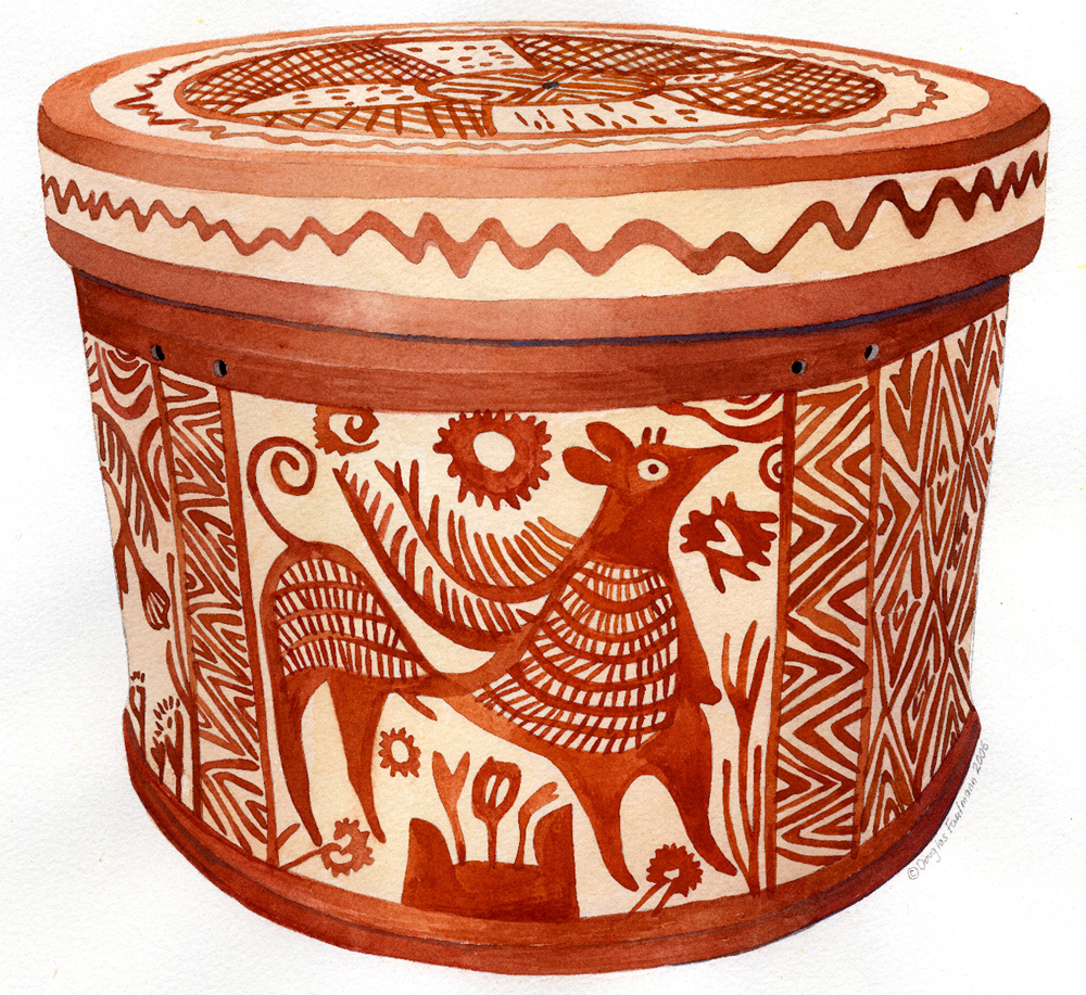
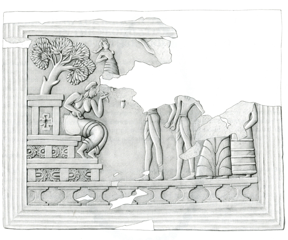
Slide show from left to right (click on each photo to enlarge): four views of artists drawing in the lab and recording measurements in the field, four drawings of objects and architecture, and a pair of ortho-photos of Mochlos. Drawings by D. Faulmann.
Equipment

Staff
Douglas Faulmann received his Master of Fine Arts degree from the University of North Carolina at Greensboro in 1994. His interest in ancient history motivated him to attend classes in archaeology as an undergraduate, and this led to his work on the archaeological excavation at Mochlos, Crete, co-directed by Professor Jeffrey Soles, in the summer of 1990. There he was the architect and illustrator for eight years. He joined the staff of the Study Center in 1998, and he remains a member of the Mochlos Excavation Project. Doug is also a member of the INSTAP Publication Team; this work takes him to many excavation sites and museums around the Aegean region. His interests include: investigating and continuing the use of traditional techniques, including watercolor, to illustrate ancient artifacts; architectural reconstruction of ancient buildings and monuments; and studying and utilizing the latest digital technologies to assist in the illustration of archaeological remains.
Recent Publications
Faulmann, D. 2000. “The INSTAP Publication Team: Artist’s Report,” KENTRO 3, pp. 4–5.
———. 2015. “‘Release the Drones!’ New Adventures in Aerial Photography and Photogrammetry,” KENTRO 18, pp. 2–4.
Faulmann, D., and A. Stamos. 2009. “Differential GPS: A New Tool for the Kentro,” KENTRO 12, pp. 1-3.
Vogeikoff-Brogan, N. 2016. “A Bes-Silenus Plastic Vase in the Ierapetra Archaeological Collection: The Egyptian Connection,” in Ηχάδιν ΙΙ: Τιμητικός Τόμος για τη Στέλλα Δρούγου, M. Giannopoulou and Ch. Kallini, eds., Athens, pp. 808–822.